|
|
|
|
|
SISTEMA
DE INFORMACIÓN TERRITORIAL (S.I.T.) DE LA DIRECCIÓN
PROVINCIAL DE CATASTRO Y CARTOGRAFÍA DE LA PROVINCIA DEL
CHACO
TERRITORIAL INFORMATION SYSTEM (T.I.S.) OF LAND REGISTRY AND CARTOGRAPHY OF CHACO PROVINCE
|
|
|
|
|
|
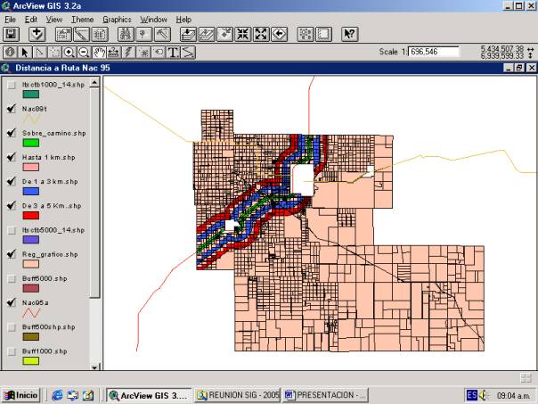
·
Ubicación e infraestructuras: Dentro
de este factor se tomó “Distancias a rutas provinciales y
nacionales”, lo cual permitió graficar en función de cuatro aspectos
0
Sobre
ruta 0
Hasta
1 Km. 0
De
1 Km. a 3 Km. 0
De
3 Km. A 5 Km. 0
Más
de 5 Km.
|
|
|
|
|
|
|
| |
3 de 4 |
|
|
Instituto de Geografía (IGUNNE). Facultad de Humanidades. UNNE. Resistencia, Chaco. Argentina |